
 Here are the details of maps for Newton Heath:


We have published three versions of this detailed map, showing how the area changed across the years. Each covers the Newton Heath area on the NE side of Manchester. Coverage stretches from Hague Street and Ten Acres Lane eastward to Brookdale Park and Aldred Street.
The railway is a major feature with the Lancashire & Yorkshire Railway's main line and Hollinwood Branch, carriage works, Lightbowne Siding and engine sheds. Other features include tramways, Newton Heath and Dean Lane stations, Brookdale Park, Ten Acres Mill, Livingstone Mill, All Saints church, Brookdale Hall, St Anne's church, St Wilfrid's church, Pavilion Theatre, Orleans Mill, Britannia Mill, Dob Lane End Mill, Meadow Mills, Rochdale Canal, Moston Brook, Lightbowne etc. On the reverse we include a selection of street directory entries.
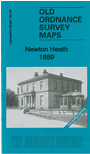
The 1889 version is fully coloured, taken from the beautiful 1st Edition OS handcoloured edition. The 1931 version is partly coloured.
The map links up with sheets 96.16 Moston to the north, 104.03 Harpurhey to the west, 105.01 Failsworth South to the east and 104.08 Manchester Clayton to the south.