We have published more than 2,100 titles in our series of Old Ordnance Survey Map reprints, including a large group in Lancashire and several around Wigan. The maps are highly detailed. They are taken from the OS 1:2,500 (or 25 inch) maps and reduced to about 15 inches to the mile. Each covers an area of a mile and a half by a mile. They show streets with individual houses, tram tracks, railway tracks and even signals, factories, wharves and such details as fountains and water troughs. They will provide hours of fascination for historians and genealogists. The maps are neatly folded and each includes a specially written introduction to the area. Maps can be purchased on our On-line Mapshop where further information about titles is given. Or visit The Index Page for a full list to the series and details of Prices.
Here are the details of maps for Wigan North:
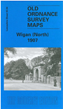
This highly detailed map covers the northern part of Wigan, with coverage stretching from Swinley Lane eastward to New Springs, and from Whelley station northward to Leyland Mill Brow. Features include Lindsay Pit, Alexandra Pit, Leeds & Liverpool Canal, railway (Lancashire Union Line), Dairy Pit, Bridge Pit, Haigh Saw Mill, Wigan Sanatorium, New Springs, Bottling Wood, Whelley station (disused), Haigh Lower Plantations, Mariebonne, Swinley, Infirmary, Whitley Reservoir, Haigh Foundries, tramways, several old shafts etc. Directories of Aspull and Haigh are included on the reverse.
The map links up with sheets 93.03 Wigan NW to the west, 93.08 Wigan to the south.
Follow this link for a complete list of our Wigan area maps.
You can order maps direct from our On-line Mapshop. For other information and prices, and other areas, go to The Index Page.
Maps in the Godfrey Edition are taken from the 25 inch to the mile map and reduced to about 15 inches to the mile. For a full list of maps for the North West, return to the North West page.
The Godfrey Edition / godfreyedition@btinternet.com / 14 April 2008