Old Ordnance Survey Maps of Skelmersdale


We have published more than 2,100 maps in our series of Old Ordnance Survey Map reprints, including a large group in Lancashire. The maps are highly detailed. They are taken from the OS 1:2,500 (or 25 inch) maps and reduced to about 15 inches to the mile. Each covers an area of a mile and a half by a mile. They show streets with individual houses, tram tracks, railway tracks and even signals, factories, wharves and such details as fountains and water troughs. They will provide hours of fascination for historians and genealogists. The maps are neatly folded and each includes a specially written introduction to the area.

Maps can be purchased on our On-line Mapshop where further information about titles is given. Or visit The Index Page for a full list to the series and details of Prices.


Here are the details of maps for Skelmersdale:

  • Lancashire Sheet 92.07 Skelmersdale 1907 - published 2001; intro by Alan Crosby

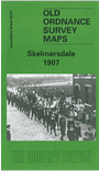
    This detailed map covers the west Lancashire town of Skelmersdale, now a 'New Town' but in 1907 a rather scattered village. Most of the village is covered and features include the LYR Skelmersdale Branch with station, White Moss Crossing Halt, mineral railway to collieries, White Moss Collieries, Lower White Moss Colliery, Market Hall, Merdale Factory, Victoria Colliery, St Paul's church, St Richard's RC church, Town Hall, Moss Side Brick Works, farms, old shafts, Sandy Lane etc. A 1918 directory of Skelmersdale is included on the reverse.


    Follow this link for a complete list of our Southport & West Lancs maps.

    You can order maps direct from our On-line Mapshop. For other information and prices, and other areas, go to The Index Page.


    Maps in the Godfrey Edition are taken from the 25 inch to the mile map and reduced to about 15 inches to the mile. For a full list of maps for the North West, return to the North West page.

    The Godfrey Edition / godfreyedition@btinternet.com / 16 April 2008