 Here are the details of maps for Barrow (NE):

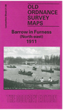
This detailed map covers the NE area of Barrow, with coverage stretching from the cemetery eastward to Roose House and southward to the Public Park. This is mainly a residential area and features include Abbey Road with tramway, Hippodrome, skating rink, Long Reins Reservoir, Central station, Ainslie Street and surrounding streets, Newbarns, Croslands Park. East of this is rural but Flass Lane runs down the map and beyond this is a section of the Furness Railway by Roose House. Street directory extracts are included on the reverse.
This map links up with Sheets 21.04 Furness Abbey to the north, 21.07 Barrow NW to the west, 21.12 Barrow E to the south.