
 Here are the details of maps for Hadleigh:

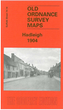
This detailed map covers the small south Suffolk town of Hadleigh, and is double-sided for maximum coverage. The map includes the town centre and extends a mile or so east into open country and as far as Valley Farm. Features include the station, malthouses, High Street, St Mary's church, coir matting factory, Angel Street, Tinker's Lane, Toppesfield Hall, George Street, Frog Hall, French's Farm, Durrant's Farm. On the reverse we include a good portion of adjacent sheet 74.13 and this covers the western part of the town, incl River Brett, Bridge Street, Broom Hill, Holbecks, cemetery, Hadleigh Bridge, Friars Hall, Hadleigh Hall. We also include a commercial directory.