
 Here are the details of maps for Gloucester SW:

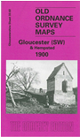
This detailed map covers the SW area of Gloucester, plus the village of Hempstead. The Gloucester area includes the Bristol Road southward to Tuffley Avenue, with a mile-long stretch of the Gloucester & Berkeley Canal. Features include Monk Meadow Dock, Baker's Quay, Llanthony Priory remains, St Luke's church, match factory, Railway Carriage & Wagon Works, Atlas Engineering Works, tramway, timber yards, High Orchard Wharf, High Orchard, malthouses, Midland Railway New Docks Branch, Llanthony Abbey Farm. The Hempsted area includes Hempsted Court, Newark Farm, St Swithin's church, Newark, site of Roman Camp. On the reverse we include extracts from an 1894 directory, including private residents Ha-Y.
The map links up with Gloucs sheet 25.14 Gloucester NW to the north and 33.03 Gloucester SE to the east.
Maps in the Godfrey Edition are taken from the 25 inch to the mile map and reduced to about 15 inches to the mile. For a full list of maps for England, return to the England page.
Alan Godfrey Maps, Prospect Business Park, Leadgate, Consett, Co Durham, DH8 7PW / sales@alangodfreymaps.co.uk / 28 October 2016