
 Here are the details of maps for Tewkesbury:

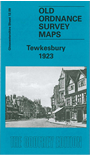
This detailed map, covering the historic town of Tewkesbury, is double-sided for maximum coverage. The main map covers the northern part of the town, with coverage extending from Barton Street northward to Mythe Farm and westward to Cork's Hill. Major features include High Street, Oldbury Road, East Street, River Avon, railway to quay and Borough Mills, Midland Railway with station (at eastern edge of map) and line northward, King John's Bridge, St Joseph's RC church, boatbuilding works. On the reverse is a large extract from adjacent sheet 12.13, extending coverage south to include St Mary's Abbey church, Workhouse, Abbey Mills, cemetery, Swilgate Bridge, site of Holme Castle. This map includes the site of the Battle of Tewkesbury.
Maps in the Godfrey Edition are taken from the 25 inch to the mile map and reduced to about 15 inches to the mile. For a full list of maps for England, return to the England page.
Alan Godfrey Maps, Prospect Business Park, Leadgate, Consett, Co Durham, DH8 7PW / sales@alangodfreymaps.co.uk / 28 October 2016