Old Ordnance Survey Maps of Fife

  • These detailed maps normally cover an area of about one and a half miles by one mile. Each map includes an introduction.
  • They are available through our On-line Mapshop

  • Here are the details of maps for Aberdour:

  • Fife Sheet 40.09 Aberdour 1894 - published 2019; intro by Alan Godfrey. ISBN.978-1-78721-247-3

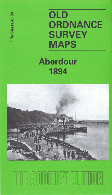
    This very detailed map gives excellent coverage of Aberdour, including Wester Aberdour, Easter Aberdour, and the harbour. On the reverse is a section of the 1913 revision of the map.

    Features include Aberdour Castle, Whitesands Bay, Hawkcraig (here referred to as Hallcraig), Aberdour House, the old church (still in ruins in 1894), Hillside, New Town, harbour and pier, Fort Haven, Woodside Hotel, etc. The introduction by Alan Godfrey explores the history of Aberdour, including the connection with Admiral Beatty during the 1st World War.


  • Follow this link for a complete list of our Fife maps.
  • You can order maps direct from our On-line Mapshop. For other information and prices, and other areas, go to The Index Page.
  • Maps in the Godfrey Edition are taken from the 25 inch to the mile map and reduced to about 15 inches to the mile. For a full list of maps for Scotland, return to the Scotland page.
    The Godfrey Edition / sales@alangodfreymaps.co.uk / 23 June 2019