Old Ordnance Survey Maps of Fife

  • These detailed maps normally cover an area of about one and a half miles by one mile. Each map includes an introduction.
  • They are available through our On-line Mapshop

  • Here are the details of maps for Buckhaven:

  • Fife Sheet 28.11 Buckhaven 1893 - published July 2020; intro by Alan Godfrey. ISBN.978-1-78721-329-6

    This detailed map of Buckhaven is double-sided for maximum coverage.

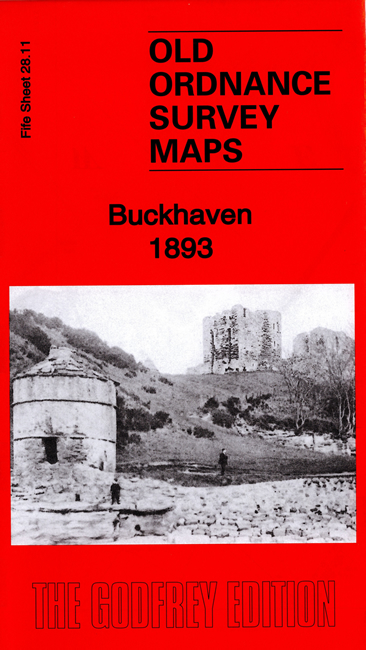
    The main map covers the western part of the town, including harbour, Buckhaven Net Factory, Wemyss & Buckhaven railway with Buckhaven station, Rosie Colliery, Wellsgreen Colliery, East Newton, Macduff's Castle, Well Cave, Dovecot Cave, Muiredge Colliery, Buckhaven Saw Mills etc.

    On the reverse we include adjacent sheet 28.12 extending coverage eastward to include the east part of the town, West Shore Street, East Shore Street, East High Street, Buckhaven Links.

    The map links up with sheet 28.08 Methil to the north.


  • Follow this link for a complete list of our Fife maps.
  • You can order maps direct from our On-line Mapshop. For other information and prices, and other areas, go to The Index Page.
  • Maps in the Godfrey Edition are taken from the 25 inch to the mile map and reduced to about 15 inches to the mile. For a full list of maps for Scotland, return to the Scotland page.
    The Godfrey Edition / sales@alangodfreymaps.co.uk / 22 June 2020