Old Ordnance Survey Maps of Fife

  • These detailed maps normally cover an area of about one and a half miles by one mile. Each map includes an introduction.
  • They are available through our On-line Mapshop

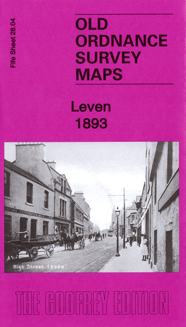
  • Here are the details of maps for Leven:

  • Fife Sheet 28.04 Leven 1893 - published 2019; intro by Alan Godfrey. ISBN.978-1-78721-279-4

    This very detailed map is double-sided for maximum coverage and includes much of adjacent sheet 29.01.

    The main map includes the Dock, Leven Bridge, railway with station and Leven Dock Branch, Durie Foundry, Hawkshaw Works, Millfield Mill, Burn Mill, Fever Hospital, Shotburn Mill, River Bank Mill, part of High Street and town centre, Leven Mills, Kirkland, Kirkland Works, Kirkland House, Methil Church ruins, etc.

    On the reverse we include sheet 29.01, extending coverage eastward to include Greig Institute, Town Hall, Durie Street, Leven Links, Carberry House, churches, Scoonie Church remainsm Scoonie Links, etc.


  • Follow this link for a complete list of our Fife maps.
  • You can order maps direct from our On-line Mapshop. For other information and prices, and other areas, go to The Index Page.
  • Maps in the Godfrey Edition are taken from the 25 inch to the mile map and reduced to about 15 inches to the mile. For a full list of maps for Scotland, return to the Scotland page.
    The Godfrey Edition / sales@alangodfreymaps.co.uk / 19 October 2019