
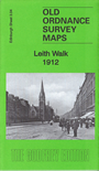
 Here are the details of maps for Leith (S):
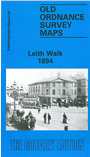

We have published two versions of this detailed map, showing how the area changed across the years. They cover much of south Leith, with coverage stretching from Broughton Road eastward to Restalrig Road, and from South Leith church southward to Montgomery Street.
Features (from 1912 version) include the Leith Walk area in detail with individual buildings shown, North British Railway with Leith Walk station, Powderhall station, Easter Road station; Leith Central Branch with Central Station terminus; Caledonian Railway Leith Line with Restalrig goods station, Bonnington goods station; Leith Links, tramways and tram depot, Quarryholes, Eastern Cemetery, South Leith Church, Lochend, Hermitage, Claremont Park, Hawkhill Quarry, Gayfield, Edinburgh & Leith Cemetery, Shrubhill Cable Power Depot, factories, chapels and much more.
The map links up with Edinburgh Sheets 1.16 Leith Hbr to the north, 3.03 Inverleith to the west, 4.05 Portobello West to the east, 3.08 Holyrood to the south.