
 Here are the details of maps for Leith (W):

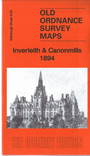
This detailed map covers western Leith around Inverleith, with coverage stretching from Fettes College eastward to East Claremont Street, and from Granton Road station southward to Raeburn Place.
Features include Royal Botanic Gardens, Inverleith House, Fettes College, Malcolm House, Comeley Bank area, Academy and Grange cricket grounds, St James church, Heriot Hill area, Canonmills area, Tanfield area, Beaverbank area, St Marks church, Powderhall Grounds, Edinburgh Cemetery, Chancelot Flour Mills, Silvermills area, NBR lines with Warriston Junction, Warriston Park, tramways etc. On the reverse we include a selection of street directory entries, incl Brandon Terrace, Eyre Crescent, Golden Acre Terrace, Henderson Row, Howard Place, Inverleith Avenue/Place/Row/Terrace, Royal Crescent, Scotland Street, Warriston Crescent, Cumberland Street.
The map links up with Edinburgh Sheets 1.15 Newhaven to the north, 3.04 Leith Walk to the east, 3.07 Princes Street to the south.