 Here are the details of maps for Colwyn:

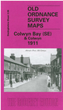
This detailed map covers the village of Colwyn and the SE area of Colwyn Bay. Coverage stretches from Rhiw Road eastward toMeiriadog Road, Colwyn, and from the shore southward to Pentre-uchaf. Features include Bryn-eirias, Glan-y-don, Pont Afon-lwyd, Colwyn Mill, Colwyn House, St Catherine's church, railway with Old Colwyn station, Marien Hotel, Min-y-don, cemetery, St Paul's church etc. On the reverse we include an Old Colwyn Trade Directory and extracts from a Colwyn Bay trade directory.
The map links up with sheets 3.03 Colwyn Bay North to the NW, 03.07 Colwyn Bay SW to the west.