Old Ordnance Survey Maps of Colwyn Bay (S)


We have published more than 2,100 maps in our series of Old Ordnance Survey Map reprints, including a group in Denbighshire / Clwyd. The maps are highly detailed. They are taken from the OS 1:2,500 (or 25 inch) maps and reduced to about 15 inches to the mile. Each covers an area of a mile and a half by a mile. They show streets with individual houses, tram tracks, railway tracks and even signals, factories, wharves and such details as fountains and water troughs. They will provide hours of fascination for historians and genealogists. The maps are neatly folded and each includes a specially written introduction to the area. Maps can be purchased on our On-line Mapshop where further information about titles is given. Or visit The Index Page for a full list to the series and details of Prices.


Here are the details of maps for Colwyn Bay South:

  • Denbighshire Sheet 03.07 Colwyn Bay (SW) 1911 - published 2003; intro by Derrick Pratt

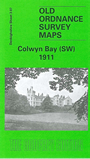
    This detailed map covers the SW corner of Colwyn Bay, around Woodland Park and York Road. Coverage then extends south west into the countryside, including part of Llandrillo-yn-Rhos parish. Features include Pant-y-gloch Farm, Coed Isaf, Pwll-y-crochan Woods, Colwyn Bay Golf Course, Pwll-y-crochan Hotel, and many scattered houses. Coverage extends westward to Mochdre. On the reverse we include a list of residents etc from an 1890 directory.

    The map links up with sheets 3.03 Colwyn Bay North to the north, 03.08 Colwyn to the east.


    Follow this link for a complete list of our Denbighshire maps.

    You can order maps direct from our On-line Mapshop. For other information and prices, and other areas, go to The Index Page.


    Maps in the Godfrey Edition are taken from the 25 inch to the mile map and reduced to about 15 inches to the mile. For a full list of maps for Wales, return to the Wales page.

    The Godfrey Edition / godfreyedition@btinternet.com / 7 March 2008