Old Ordnance Survey Maps of Tintagel


We have published more than 2,000 maps in our series of Old Ordnance Survey Map reprints, including a small group in Cornwall. The maps are highly detailed. They are taken from the OS 1:2,500 (or 25 inch) maps and reduced to about 15 inches to the mile. Each covers an area of a mile and a half by a mile. They show streets with individual houses, tram tracks, railway tracks and even signals, factories, wharves and such details as fountains and water troughs. They will provide hours of fascination for historians and genealogists. The maps are neatly folded and each includes a specially written introduction to the area. Maps can be purchased on our On-line Mapshop where further information about titles is given. Or visit The Index Page for a full list to the series and details of Prices.


Here are the details of maps for Tintagel or Trevena:

  • Cornwall Sheet 10.13 Tintagel 1905 - published 2007; introduction by Tom Greeves.

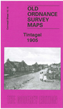
    This detailed map covers the village of Tintagel, previously called Trevena. In 1820 the village was described as having houses "laid out in a regular street, but they are in general detached buildings, very mean, and many of them falling into a state of decay". Trevena village was already referred to as 'Tintagel Town' and as a "wild-looking place". Our map covers this village, including the outlying hamlets of Treven and (at foot of map) Trewithen; St Materiana's church is outside the village. Other features include King Arthur's Castle Hotel, Tintagel Head, Dunderhole Point, Higher Penhallic Point, Long Grass Quarry, King Arthur's Castle, and The Island with ruins of St Juletta's chapel. The map is double-sided and on the reverse we include much of adjacent sheet 10.09, which covers the coastal area of Tingael Haven, Barras Nose, Smith's Cliff, Willapark and The Sisters rocks. The connections with King Arthur and King Mark give Tintagel especial appeal, and the history of the place is explored in the introduction by Tom Greeves.


    Follow this link for a complete list of our Cornwall Series maps.

    You can order maps direct from our On-line Mapshop. For other information and prices, and other areas, go to The Index Page.


    Maps in the Godfrey Edition are taken from the 25 inch to the mile map and reduced to about 15 inches to the mile. For a full list of maps for the South West, return to the South West page.

    The Godfrey Edition / godfreyedition@btinternet.com / 16 February 2007