Old Ordnance Survey Maps of Essex

  • These detailed maps normally cover an area of about one and a half miles by one mile. Each map includes an introduction.
  • They are available through our On-line Mapshop

  • Here are the details of maps for Chadwell Heath:

  • Essex (New Series) 79.09 Chadwell Heath 1914 - published 1993; introduction by Tony Clifford

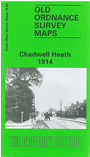
    This detailed map covers the busy village of Chadwell Heath, between Ilford and Romford. The GER runs through the map, with station, and Romford Road is almost parallel. Many streets are shown half complete as the village grows into a suburb. The tramways stretches to the Ilford border. Coverage stretches from Grove Road eastward to Bolton Farm; Chadwell Heath is neatly covered. Other features include Ilford Isolation Hospital. We include directories for Chadwell Heath in 1874, 1894 and 1912.

    The map links up with Essex Sheet 78.12 Newbury Park to the west, 79.10 Romford to the east, and 79.13 Becontree Heath to the south.


    Follow this link for a list of our maps for Essex in outer London or here for Essex county.

    You can order maps direct from our On-line Mapshop. For other information and prices, and other areas, go to The Index Page.


    Maps in the Godfrey Edition are taken from the 25 inch to the mile map and reduced to about 15 inches to the mile. For a full list of maps for England, return to the England page.

    Alan Godfrey Maps, Prospect Business Park, Leadgate, Consett, Co Durham, DH8 7PW / godfreyedition@btinternet.com / 31 August 2011
    >