We have published more than 2,500 maps in our series of Old Ordnance Survey Map reprints, including a large group in Lancashire. The maps are highly detailed. They are taken from the OS 1:2,500 (or 25 inch) maps and reduced to about 15 inches to the mile. Each covers an area of a mile and a half by a mile. They show streets with individual houses, tram tracks, railway tracks and even signals, factories, wharves and such details as fountains and water troughs. They will provide hours of fascination for historians and genealogists. The maps are neatly folded and each includes a specially written introduction to the area. Maps can be purchased on our On-line Mapshop where further information about titles is given. Or visit The Index Page for a full list to the series and details of Prices.
Here are the details of maps for Roe Cross:
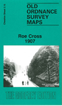
This detailed map is double-sided for maximum coverage. It covers the rural area east and SE of Stalybridge, around Roe Green, including part of Mottram parish. The main map covers the area from Matley Brewery Road eastward to Mottram Old Hall. The Mottram Road runs down the map, with a tramway as far as Roe Green. Other features include Spoutgreen, Lower Roe Cross, Bardsley Gate, a scattering of buildings along the main road, Hobson Moor, Stalyhill. On the reverse we include about half of adjacent sheet 3.11, covering the area to the north; features here include Walkerwood Reservoir, Sidebottom Fold, Wild Bank.
The map links up with Cheshire sheet 3.10 Stalybridge to the west and with 3.16 Hadfield to the east.
Follow this link for a complete list of our Tameside maps.
You can order maps direct from our On-line Mapshop. For other information and prices, and other areas, go to The Index Page.
Maps in the Godfrey Edition are taken from the 25 inch to the mile map and reduced to about 15 inches to the mile. For a full list of maps for the North West, return to the North West page.
The Godfrey Edition / godfreyedition@btinternet.com / 3 Feb 2011