We have published more than 2,500 maps in our series of Old Ordnance Survey Map reprints, including a large group in Lancashire. The maps are highly detailed. They are taken from the OS 1:2,500 (or 25 inch) maps and reduced to about 15 inches to the mile. Each covers an area of a mile and a half by a mile. They show streets with individual houses, tram tracks, railway tracks and even signals, factories, wharves and such details as fountains and water troughs. They will provide hours of fascination for historians and genealogists. The maps are neatly folded and each includes a specially written introduction to the area. Maps can be purchased on our On-line Mapshop where further information about titles is given. Or visit The Index Page for a full list to the series and details of Prices.
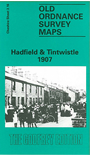
Here are the details of maps for Hadfield:
This detailed map covers the village of Tintwistle and the northern part of Hollingworth in Cheshire, and the northern part of Hadfield in Derbyshire. Features include Arnfield Reservoir, Woolley Mill, Millbrook House, Market Street Hollingworth, St Mary's church (near foot of map), Arrowscroft Mill, River Etherow Bleach Works, Wedneshough Green (in SW corner of map), GCR Waterside Branch, Bridge Mill, Waterside Mill, River Etherow, Christ Church Tintwistle, Cockerhill, Station Mill Hadfield, The Cross, Old Hall Square, chapels, White Mill, St Charles RC church, Mersey Bank etc. On the reverse we include directories of Hadfield and Tintwistle.
The map links up with Cheshire sheet 3.15 Roe Cross to the west.
Follow this link for a complete list of our Tameside maps.
You can order maps direct from our On-line Mapshop. For other information and prices, and other areas, go to The Index Page.
Maps in the Godfrey Edition are taken from the 25 inch to the mile map and reduced to about 15 inches to the mile. For a full list of maps for the North West, return to the North West page.
The Godfrey Edition / godfreyedition@btinternet.com / 3 Feb 2011