We have published more than 1,900 maps in our series of Old Ordnance Survey Map reprints, including a growing title range in East Anglia. The maps are highly detailed. They are taken from the OS 1:2,500 (or 25 inch) maps and reduced to about 15 inches to the mile. Each covers an area of a mile and a half by a mile. They show streets with individual houses, tram tracks, railway tracks and even signals, factories, wharves and such details as fountains and water troughs. They will provide hours of fascination for historians and genealogists. The maps are neatly folded and each includes a specially written introduction to the area. Maps can be purchased on our On-line Mapshop. Or visit The Index Page for a full list to the series and details of Prices.
Here are the details of maps for Brandon
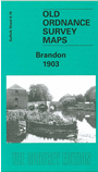
This map straddles the Suffolk border, and is also Norfolk Sheet 92.16. It covers the town of Brandon in good
detail, and features here include High Street, Market Hill, London Road, Thetford Road, Bury Road, Gashouse Drove, old limekilns,
fur manufactory, St Peter's church. Town Street, Brandon Hall and Foord House are in the SW corner. The Little Ouse River runs through the map
and north of this is the Great Eastern Railway with (in Norfolk) Brandon station. A directory of Brandon in 1896 is included on the back.
Follow this link for a complete list of our Suffolk Series maps.
You can order maps direct from our On-line Mapshop. For other information and prices, and other areas, go to The Index Page.
Maps in the Godfrey Edition are taken from the 25 inch to the mile map and reduced to about 15 inches to the mile. For a full list of maps for East Anglia, return to the East Anglia page.
The Godfrey Edition / godfreyedition@btinternet.com / 23 February 2006