 Here are the details of maps for Aldeburgh:

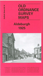
This detailed map provides good coverage of the small town of Aldeburgh. We include two maps, Sheets 60.16 and 69.04, printed side by side to cover two miles of the coast. The town of Aldeburgh is covered on the main map, where features include the church, station, High Street, Belstead House, Alde House, Town Hall, Aldeburgh Lodge. The poet George Crabbe is remembered in Crabbe Street though today Aldeburgh is perhaps better known for Benjamin Britten. The second map continues coverage southward, including Fort Green, Slaughden, Westrow Reach and a Martello Tower. We include an 1896 directory of Aldeburgh on the reverse, together with a 1915 timetable for the Aldeburgh branch.