
The following titles are all taken from the OS 25" maps and reduced to a scale of approximately 14 inches to the mile. Each covers an area of a mile and a half by one mile, and includes an introduction. Click on the links below for further details. All maps are available from our On-line Mapshop.
 Here are the details of maps for Morley (S)

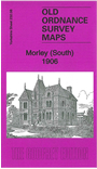
This detailed map covers the southern part of Morley, with coverage from Thornfield southward to Howley Park Colliery and eastward to Tingley Common.
Features include Britannia Quarries, Howley Park Quarries, Finsdale Quarry, Birks area, mineral railways to quarries, Howley Hall Farmhouse, Howley Park and golf course, Morley Tunnel, Glen Mills, short stretch of GNR Gildersome Branch, Tingley House, Stump Cross Inn, America Moor, Britannia Mills, Cross Hall etc. Extracts from an 1889 directory are included on the reverse.
The map links up with sheet 232.04 Morley to the north, 232.07 Upper Batley to the west and 232.12 Lower Soothill to the south.