
The following titles are all taken from the OS 25" maps and reduced to a scale of approximately 14 inches to the mile. Each covers an area of a mile and a half by one mile, and includes an introduction. All maps are available from our On-line Mapshop.
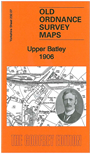 Here are the details of maps for Upper Batley:

This detailed map covers the northern part of Batley, including part of Upper Batley and Carlinghow, the eastern part of Birstall, and Howden Clough.
Features include GNR railway with Howden Clough and Upper Batley stations, West End Colliery, Birkby Brow Colliery, Howley Dye Works, Boggard Fields, part of LNWR Birstall Branch, tramway, Batley Hall, Wensleydale Mills, Brookroyd, Brownhill, Woodlands, Birstall Methodist Chapel, Britannia Mills, Upper Birstall station, Copley Hill, Gelderd Road Quarry etc.An 1897 timetable for the Birstall Branch is included on the reverse.
The map links up with sheet 232.03 Gildersome Street to the north, 232.06 Birstall to the west, 232.08 Morley South to the east, 232.11 Batley to the south