
 Here are the details of maps for Cross Gates:

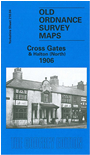
This detailed map covers Cross Gates (or Crossgates) and parts of other villages on the east side of Leeds. Coverage runs from Killingbeck Colliery eastward to Manston Lodge, with Whitkirk Lane End in the SE corner. Cross Gates is the main village, with features including station, Austhorpe Road, Manston Lodge, Station Road, The Orchard, and coverage extending north to St James church. To the south is Whitkirk, with St Mary's church at the foot of the map. In the NW quarter of the map the dominant feature is Seacroft Infectious Hospital, with Killingbeck Cemetery. South of this is the disused Killingbeck Colliery and the northern part of Halton, incl Chapel Street, Graveleythorpe. Good coverage of a still semi-rural area. We include directories of Manston (incl Crossgates) and Whitkirk in 1901 on the reverse.
The map links up with Sheets 218.03 Leeds East to the west and 218.08 Temple Newsam to the south.