Old Ordnance Survey Maps of Teesside

  • These detailed maps normally cover an area of about one and a half miles by one mile. Each map includes an introduction.
  • They are available through our On-line Mapshop

  • Here are the details of maps for Normanby:

  • Yorkshire Sheet 16.04 Normanby 1927 - published 2015; intro by Robert Woodhouse. ISBN.978-1-84784-870-3

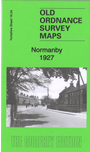
    This detailed map covers the village of Normanby, south of Teesside.

    Features include village centre with individual buildings neatly shown, LNER Normanby Branch, Coal Depot, Flatts Lane Junction, High Grange Farm, western tip of Eston, Infectious Diseases Hospital, Normanby Hall, Spencer Beck Farm, Old Hall, Orchard Grove, St Helen's church, Bottoms Farm, Thorntree Farm etc. A 1905 directory of Normanby is included on the reverse.

    The map links up with sheet 17.01 Eston to the east.


  • You can order maps direct from our On-line Mapshop. For other information and prices, and other areas, go to The Index Page
  • Maps in the Godfrey Edition are taken from the 25 inch to the mile map and reduced to about 15 inches to the mile. Follow this link for a complete list of our Teesside maps; or here for the whole Yorkshire series.
    Alan Godfrey Maps, Prospect Business Park, Leadgate, Consett, Co Durham, DH8 7PW / sales@alangodfreymaps.co.uk / 16 November 2017