
 Here are the details of maps for Woodstock & Blenheim:

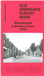
This detailed map covers the town of Woodstock, together with Blenheim Palace and much of Blenheim Park and Lower Park. Features in the town include railway station, Woodstock Union Workhouse, St Mary's church, Woodstock House, Oxford Street, High Street, Market Street, Hensington House, Hensington Within. Blenheim Palace is shown further SW, with The Lake, Queen Pool, Column of Victory, Fair Rosamond's Well, and many avenues etc. The borough of New Woodstock was founded by Henry II who visited Woodstock Park to meet his lover Rosamund Clifford, 'Fair Rosamund'. One of Donizetti's loveliest operas, Rosmonda D'Inghilterra, is set in Woodstock Park, and other composers were also drawn to the tale. So was the GWR, for the branch line's engine was called Fair Rosamund. Blenheim Palace was built by Vanbrugh for John Churchill, 1st Duke of Marlborough. Our map includes a directory of Woodstock in 1899 plus a timetable for the railway branch.