
 Here are details of maps for Warminster:
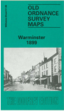
Wiltshire Sheet 51.08 Warminster 1899 - published 1992; intro by Danny Howell. ISBN.978-0-85054-483-1 
This detailed map gives good coverage of Warminster, with coverage extending eastward to Woodcock and southward to Warminster Common.
Features include town centre with individual buildings neatly shown, railway with station, Woodcock Farm, St John's church Woodcock, St Lawrence's Chapel, Station Saw Mills, East End House, Manor House, Portway House, Town Hall, Christ Church, Damask Farm, Thurleigh House, St Boniface Missionary College, St Deny's church, Cold Harbour, Pound Street Factory, Warminster Union Workhouse, Sambourne, Warminster Common, Fever Hospital, malthouse etc. Extracts from an 1899 directory are included on the reverse.