
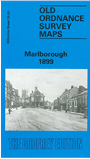
 Here are the details of maps for Marlborough:

This detailed map is double-sided for maximum coverage and covers most of the town area.
Features on the main map include High Street area with all buildings neatly delineated; St Margarets area, St Mary's church, St Martins area, Marlborough Workhouse, Barton Farm, The Mount, Marlborough College, St Peter & St Paul's church, Grammar School, The Green, Poulton House, Stonebridge Lane, Town Mill, Cotton House, Littlefield, Barton Copse, Deverill House, Summerfield etc.
On the reverse we include part of adjacent sheet 29.13 extending coverage south to include GWR station, Midland & South Western Jct Railway station, Preshute, St George's House, Preshute House, Cow Bridge. A list of private residents from a contemporary directory is also included.