
 Here are details of maps of Box:
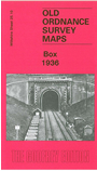
Wiltshire Sheet 25.10 Box 1936 - published 2006; intro by Tony Painter. ISBN.978-1-84151-928-9 
This detailed map covers the village of Box, probably best known for Brunel's railway tunnel. The railway runs through the map and includes the western portal to the tunnel and both Box station and Box Mill Lane Halt. Other railway features are sidings and the engine shed used until 1919 for a banking engine, said to be the inspiration for the Rev Awdrey's Thomas the Tank Engine (the author lived in Box). Other features include the village with individual houses shown, the church, cemetery, pubs etc; The Bassetts, stone yard, Fogleigh House to the north. To the west the map covers part of Ashley, including Ashley Manor, Ashley Green; Middlehill; and the small village of Ditteridge (or Ditcheridge) including St Christopher's church. The author gives a full history of Box, including information about local quarrying (although a tramway by the A4 road had been removed by 1936). Directories of Box and Ditteridge are included on the reverse.