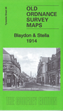
 Here are the details of maps for Blaydon & Stella:
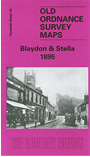

We have published two versions of this map, showing how the area changed across the years. Coverage of each extends as far west as Bewes Hills and Liddells Fell.
Features on the map include the centre of Blaydon with individual buildings neatly shown, NER railway with station, St Cuthbert's church, St Joseph's RC church, Shibdon Dene, Priestman Ottovale Coke Ovens, Blaydon Burn Wagonway, Blaydon Iron Works, Towneley Main Wagonway, Path Head, Image Hill, Stella Staith, Stella House, Hedgefield House, etc.
The map links up with Tyneside Sheet 25 Newburn to the north, 26 Scotswood & Derwenthaugh to the east and Tyneside Sheet 27 Whickham & Swalwell to the south-east.
Maps in the Godfrey Edition are taken from the 25 inch to the mile map and reduced to about 15 inches to the mile. For a full list of maps for the North East, return to the North East page.
The Godfrey Edition / sales@alangodfreymaps.co.uk / 22 February 2018