
 Here are the details of maps for Stowmarket:

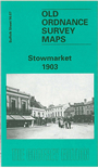
This detailed map provides good coverage of the Suffolk town of Stowmarket, with coverage extending eastward to Mill Street, Sheepcote Hall and Bramford Farm. Features on the map include Market Place, church, station, malthouses with railway sidings, Violet Hill, Abbot's Hall, Lockington House, Bury Street, Ipswich Street, California, River Gipping, the chemical works of Prentice & Co (who manufactured cordite for military use), Suffolk Iron Works. The map is notable for its many malthouses: more than 20 are shown, several with rail connections. On the reverse we include an 1896 directory to the town, including private residents and the commercial entry.