Old Ordnance Survey Maps of Sandwell & The Black Country

  • These detailed maps normally cover an area of about one and a half miles by one mile. Each map includes an introduction.
  • They are available through our On-line Mapshop

  • Here are the details of maps for Blackheath:

  • Staffordshire Sheet 72.05 Rowley Regis & Blackheath 1902 - published 1992; intro by John Maddison. ISBN.978-0-85054-484-8

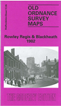
    This detailed map, which is split between Staffordshire and Worcestershire, covers the southern part of Rowley Regis, together with Blackheath, and coverage extends eastward to Cakemore Brick Works and Colliery.

    Features include GWR Stourbridge Extension with Rowley Regis station, Bellend Colliery, Bell End area, Ross, Hawes Hill, St Paul's church, Cakemore Farm, Hurst Green area, Lower Holt Farm, part of Causeway Green Canal, Cakemore Brick Works,

    The map links up with Staffordshire sheets 71.08 Cradley Heath to the west, 72.06 Warley to the west and Worcestershire sheets 5.01 Whiteheath Gate to the north and 5.09 Combeswood to the south.


  • For a full list of maps of Sandwell and Dudley go to the Sandwell and Dudley pages, or to the West Midlands page for all maps of the area.
  • You can order maps direct from our On-line Mapshop. For other information and prices, and other areas, go to The Index Page.
  • Maps in the Godfrey Edition are taken from the 25 inch to the mile map and reduced to about 15 inches to the mile. For a full list of maps for England, return to the England page.
    Alan Godfrey Maps, Prospect Business Park, Leadgate, Consett, Co Durham, DH8 7PW / sales@alangodfreymaps.co.uk / 13 January 2018