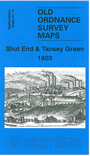
 Here are the details of maps for Tansey Green:

This detailed map covers an area west of Dudley that was rich in industry, vividly portrayed here. The map includes the northern fringe of Kingswinford, including St Mark's church and St Mary's church, but transport and industry dominate. Features include the Stourbridge Extension Canal, GWR Kingswinford Branch, numerous mineral railways, Planet Colliery, Shutend Colliery, Stourbridge Extension Colliery, Shutend Old Colliery, Himley Colliery, several disused pits, Corbyn's Hall iron works, Oak Farm brick works, Hunt's corn mill, several brick works, tramway. Angus Dunphy's essay provides a full history to this area, which was already in decline. Directories to Kingswinford and Pensnett are also included.
The map links up with Staffordshire Sheet 67.10 Gornalwood to the north, 67.13 Wall Heath to the west, 67.15 Dudley West to the east and 71.02 Brockmoor to the south.
You might find this Index Map useful.