Old Ordnance Survey Maps of Shropshire

  • These detailed maps normally cover an area of about one and a half miles by one mile. Each map includes an introduction.
  • They are available through our On-line Mapshop

  • Here are the details of maps for Church Stretton:

  • Shropshire Sheet 56.09 Church Stretton 1901 - published 2009; intro by Derrick Pratt. ISBN.978-1-84784-242-8

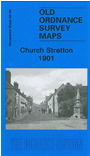
    This detailed map of Churh Stretton is double-sided for maximum coverage. The main map covers the southern half of the town, with coverage stretching from St Laurence's church southward to the Brockhurst Castle site. Features include Stretton House, railway with station, Hydropathic Hotel, Market Hall, Ragleth Wood, Sandford Avenue (laid out but not yet built on.) On the reverse we include part of adjacent map 56.05 extending coverage northward to include Burway House, Ashbrook, Workhouse, part of Carding Mill Valley, Burway Hill.


  • Follow this link for a complete list of our Shropshire or Telford maps.
  • You can order maps direct from our On-line Mapshop. For other information and prices, and other areas, go to The Index Page.
  • Maps in the Godfrey Edition are taken from the 25 inch to the mile map and reduced to about 15 inches to the mile. For a full list of maps for England, return to the England page.
    The Godfrey Edition / sales@alangodfreymaps.co.uk / 30 January 2018