
Old Ordnance Survey Maps of Shropshire
These detailed maps normally cover an area of about one and a half miles by one mile. Each map includes an introduction.
They are available through our On-line Mapshop
 Here are the details of maps for Oakengates (South):
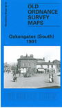
Shropshire Sheet 36.15 Oakengates (South) 1901 - published 1995; intro by Barrie Trinder. ISBN.978-0-85054-748-1 
This detailed map of Oakengates covers the southern part of the town and stretches as far south to include Pudley Hill Colliery and Forge Row just south of Hollinswood. From west to east includes Mossey Green and Snowhill. Features on the map include Snedhill Barracks, St Peter's Church, Steel Works, Pudleyhill Colliery, Holy Trinity Church, Oakengates Station and GWR Railway Line. On the reverse of the map we include an extract from a commercial directory.
This map links up with Shropshire Sheet 36.10 Hadley to the North-West, 36.11 Wrockwardine Wood to the North, 36.14 Ketley to the West, 43.02 Lawley to the South-West and 43.03 Malins Lee to the South
Follow this link for a complete list of our Shropshire or Telford maps.
You can order maps direct from our On-line Mapshop.
For other information and prices, and other areas, go to The Index Page.
Maps in the Godfrey Edition are taken from the 25 inch to the mile map and reduced to about 15 inches to the mile.
For a full list of maps for England, return to the England page.
The Godfrey Edition / sales@alangodfreymaps.co.uk / 30 January 2018