
Old Ordnance Survey Maps of Shropshire
These detailed maps normally cover an area of about one and a half miles by one mile. Each map includes an introduction.
They are available through our On-line Mapshop
 Here are the details of maps for Oswestry (South):
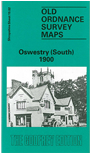
Shropshire Sheet 19.02 Oswestry (South) 1900 - published Feb 1991; intro by Barrie Trinder. ISBN.978-0-85054-415-2 
This detailed map is one of two maps which we publish of Oswestry and shows the southern section of the town. Coverage stretches as far north as St David's Church and Smithfield Cattle Market and as far south as St Anne's Church in Morda and Oswestry Union Workhouse. Other features include the Gas Works, Cemetery, Victoria Works, Our Lady & St Oswald's RC Church and the Cambrian Railway Line. On the reverse of the map we include a continuation of a commercial directory (n-z) from Oswestry sheet 12.14.
This map links up with Shropshire Sheet 12.14 Oswestry 1900
Follow this link for a complete list of our Shropshire or Telford maps.
You can order maps direct from our On-line Mapshop.
For other information and prices, and other areas, go to The Index Page.
Maps in the Godfrey Edition are taken from the 25 inch to the mile map and reduced to about 15 inches to the mile.
For a full list of maps for England, return to the England page.
The Godfrey Edition / sales@alangodfreymaps.co.uk / 30 January 2018