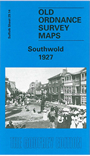
Suffolk Sheet 29.14 Southwold 1927 - published 1999; introduction by Robert Malster. ISBN 978-1-84151-032-3 
This detailed map covers the
small seaside resort of Southwold, with a population of around 4,000 at the time of the map. Features include the Pier, St Edmund's church, South Green,
East Green, St Edmund's Green, North Green, Skilman's Hill, bathing huts, Southwold Common, Southwold Railway and station, Grand Hotel, Buss Creek,
Bridgefoot Marshes. On the reverse we include a directory of Southwold in 1925.
Follow this link for a complete list of our Suffolk Series maps.
You can order maps direct from our On-line Mapshop.
For other information and prices, and other areas, go to The Index Page.
Maps in the Godfrey Edition are taken from the 25 inch to the mile map and reduced to about 15 inches to the mile.
For a full list of maps for East Anglia, return to the East Anglia page.
The Godfrey Edition / sales@alangodfreymaps.co.uk / 24 November 2017

 Here are the details of maps for Southwold