Old Ordnance Survey Maps of Selkirkshire

  • These detailed maps normally cover an area of about one and a half miles by one mile. Each map includes an introduction.
  • They are available through our On-line Mapshop

  • >

    Here are the details of maps for Selkirk:

  • Selkirkshire Sheet 12.05 Selkirk 1897 - published 1999; intro by John Griffiths. ISBN.978-1-84151-131-5

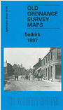
    This detailed map captures Selkirk, a town that was transformed in the 19th century by the development of the textile industry. Numerous woolen mills are a major factor here, close to the Etrick Water. Coverage of our map stretches from Selkirk Bridge eastward to the Selkirk Hills, and from Knowepark School and Brierylaw cemetery southward to Haining Loch. Features include Ettrickbank Mill, Cheviot Mills, Bridgehaugh Mills, Yarrow Mill, Forest Mill, Riverside Mill, railway station, Heatherlie, Elm Park, Market Place, Peel Hill (site of castle), The Haining, Deer Park, Rosebank Quarry. On the reverse we include extracts from a contemporary trade directrory.


  • Follow this link for a complete list of our Selkirkshire maps.
  • You can order maps direct from our On-line Mapshop. For other information and prices, and other areas, go to The Index Page.
  • Maps in the Godfrey Edition are taken from the 25 inch to the mile map and reduced to about 15 inches to the mile. For a full list of maps for Scotland, return to the Scotland page.
    The Godfrey Edition / sales@alangodfreymaps.co.uk / 13 November 2016