
 Here are the details of the map for Grangemouth:

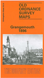
This detailed map of Grangemouth is double-sided for maximum coverage. The main map covers the centre and south of the town, with coverage stretching from the Old Dock southward to Abbotsgrange, and from Carron Old Wharf eastward to Oxgang. Features include much of Grangemouth Docks, Old Dock, Upper Dock, Caledonian Saw Mills, Town Hall, Caledonian Railway Grangemouth Branch with station, sidings, timber basin, much of Old Harbour, Eastend, Newhouse, Granbge Burn, Carronflats, site of Abbots Grange, Avon Hall, town centre with individual buildings neatly shown, etc.
On the reverse we include a section of adjacent sheet 25.09 extending coverage north to include New Dock, Forth & Clyde Canal, locks, River Carron, Heuck, Grangemouth Colliery Barony No.3 Pit, quay.