Old Ordnance Survey Maps of Stirlingshire

  • These detailed maps normally cover an area of about one and a half miles by one mile. Each map includes an introduction.
  • They are available through our On-line Mapshop

  • Here are the details of the map for south Stirling:

  • Stirlingshire Sheet 17.07 St Ninians 1896 - published 1984. ISBN.978-0-90755-461-5

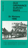
    This detailed map covers the area south of Stirling, including the village of St Ninians and part of Cambusbarron.

    Features include Polmaise Castle, Polmaise Home Farm, Torbrex House, Coxet Hill, Newhouse area, St Ninians village, churches, Borstonebrae, Randolph Field etc.

    On the reverse we include Six Inch to the Mile sheet 17NE, covering Stirling, St Ninians, and the area eastward to Crook Bridge and the Bannock Burn. Note that the introduction to this map is on sheet 17.03 Stirling.

    The map links up with sheet 17.03 Stirling to the north.


  • Follow this link for a list of our maps for Stirlingshire or here for a general list for Scotland.
  • You can order maps direct from our On-line Mapshop. For other information and prices, and other areas, go to The Index Page.
  • Maps in the Godfrey Edition are taken from the 25 inch to the mile map and reduced to about 15 inches to the mile. For a full list of maps for England, return to the England page.
    Alan Godfrey Maps, Prospect Business Park, Leadgate, Consett, Co Durham, DH8 7PW / sales@alangodfreymaps.co.uk / 21 November 2016