Old Ordnance Survey Maps of Roxburghshire

  • These detailed maps normally cover an area of about one and a half miles by one mile. Each map includes an introduction.
  • They are available through our On-line Mapshop

  • Here are the details of maps for Kelso:

  • Roxburghshire sheet 10.02 Kelso 1919 - published 2014; intro by Alan Godfrey. ISBN.978-1-84784-791-1

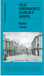
    Our detailed map of Kelso is double-sided for maximum coverage.

    The main map covers the centre of the town with coverage extending southward to cover Maxwellheugh. Features include railway with station, Pinnaclehill, Abbey ruins, churches, Market Place, Kelso Bridge, Ednam House, Kelso Mill, Springwood Park, Springwood House, Teviot Bridge, Maxwellheugh Mill, Brigend Park etc.

    On the reverse we include a large extract of adjacent sheet 6.14, extending coverage northward to include The Crofts, District Fever Hospital, Poorhouse, North Church, Broomlands, Rosebank etc.


  • Follow this link for a complete list of our Roxburghshire maps.
  • You can order maps direct from our On-line Mapshop. For other information and prices, and other areas, go to The Index Page.
  • Maps in the Godfrey Edition are taken from the 25 inch to the mile map and reduced to about 15 inches to the mile. For a full list of maps for Scotland, return to the Scotland page.
    The Godfrey Edition / sales@alangodfreymaps.co.uk / 6 Nov 2016