Old Ordnance Survey Maps of Renfrewshire

  • These detailed maps normally cover an area of about one and a half miles by one mile. Each map includes an introduction.
  • They are available through our On-line Mapshop

  • Here are the details of maps for Port Glasgow:

  • Renfrewshire Sheet 2.11 Port Glasgow 1896 - published 2003; intro by Gilbert Bell. ISBN.978-1-84151-552-6

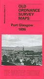
    This detailed map covers Port Glasgow, to the SE of Greenock. Coverage runs from Pottery Street and Gibshill eastward to the East Quay, and from the Clyde southward to East Douglehill.

    Features include CR Greenock Branch with Bogston and Port Glasgow stations, Wemyss Bay Junction, stretch of GSWR Greenock Branch, Ladyburn area, Bogston, Inch Works, Knocknairs Hill, Lily Bank, Birkmyre Park, Chapelton Bridge, Glen Works, shipbuilding yards, Mast Yard, tramway, West and East Harbour, Wet Dock, Gourock Rope Works, dry dock, lighthouses, churches, etc. On the reverse we include extracts from a trade directory.


  • Follow this link for a complete list of our Renfrewshire maps.
  • You can order maps direct from our On-line Mapshop. For other information and prices, and other areas, go to The Index Page.
  • Maps in the Godfrey Edition are taken from the 25 inch to the mile map and reduced to about 15 inches to the mile. For a full list of maps for Scotland, return to the Scotland page.
    The Godfrey Edition / sales@alangodfreymaps.co.uk / 11 November 2016