
 Here are the details of maps for St David's

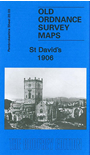
This detailed map is double-sided for maximum coverage. The main map covers the centre of this tiny city, including the cathedral, with coverage extending southward to the coast and Porth y Ffynnon. Features include Warpool Court, St Non's Bay, Pen y Cyfrwy, The Cross, town centre shown in detail, Porth Clais, Clegyr-Boia, coastguard lookout, Parc y Castell, etc.
On the reverse we include part of adjacent sheet 14.15 extending coverage northward to include The Canonry, Vicarage, and northern part of town.
Maps in the Godfrey Edition are taken from the 25 inch to the mile map and reduced to about 15 inches to the mile. For a full list of maps for Wales, return to the Wales page
The Godfrey Edition / sales@alangodfreymaps.co.uk / 4th December 2016