
 Here is information about Sheet 59:
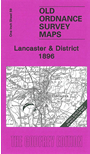
This Inch to the Mile map covers the area around Lancaster and Morecambe, with coverage extending eastward to High Bentham, and from Carnforth southward to Cockersand Abbey. Lancaster is the largest town but other features include Heysham (before the harbour was built), the Lune valley and the fells east of Lancaster. On the reverse we include a detailed map of Glasson and Conder Green, including Glasson Dock and its railway.
It is not possible to list the many hamlets, farmsteads and other topographical features shown on these maps. However, you may find it useful if we list the towns and principal villages or church parishes that are included on this map. Links are given for those for which detailed large-scale maps are also available.
Index maps are available showing the areas covered by the Inch to the Mile maps. Go to This page
You can order maps direct from our On-line Mapshop. For a full list of Inch to the Mile maps go to the Inch to the Mile page, where you will also find details of prices. For information on the rest of the series, go to The Index Page.