Northumberland 70.13 Bedlington 1921 - published 2023; intro by Alan Godfrey. ISBN.978-1-78721-644-0 
This map is double-sided for maximum coverage. It covers the area from Bedlington Market Place eastward to Sleekburn or Bedlington Station.
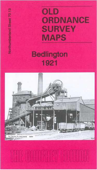
Features include Bedlington Doctor Pit, Market Place, St Cuthbert's church, East End, Bedlington Bridge, River Blyth, Humford Mill, Bedlington Colliery Railway, Blyth & Tyne Railway, Bedlington station and junction, Bedlington Colliery A Pit, Routledge's Buildings, Bedlington Bank Top, Viaduct etc
Follow this link for a complete list of our Northumberland maps.
You can order maps direct from our On-line Mapshop.
For other information and prices, and other areas, go to The Index Page.
Maps in the Godfrey Edition are taken from the 25 inch to the mile map and reduced to about 15 inches to the mile.
For a full list of maps for the North East, return to the North East page.
The Godfrey Edition / sales@alangodfreymaps.co.uk / 8 July 2023

 Here are the details of maps for Bedlington: