
 Here are the details of maps for Wooler:

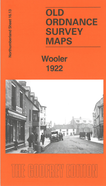
This detailed map of Wooler is double-sided for maximum coverage. It includes most of the town and the countryside to the west, towards Humbleton Hill.
Features include the town centre with individual buildings shown, railway with part of station (at top of map), St Mary's church, Bridge End, Tower, Market Place, Wooler Brewery, Glendale Union Workhouse, St Ninian's RC Church, The Kettles, Green Castle, camps, Humbleton Mill, Kenterdale Hill, Brown's Law, Humbleton Hill etc.