Old Ordnance Survey Maps of Northumberland

  • These detailed maps normally cover an area of about one and a half miles by one mile. Each map includes an introduction.
  • They are available through our On-line Mapshop

  • Here are the details of maps for Stocksfield:

  • Northumberland Sheet 101.04 Stocksfield & Bywell 1920 - published 2025; introduction by Anthea Lang. ISBN.978-1-78721-928-1

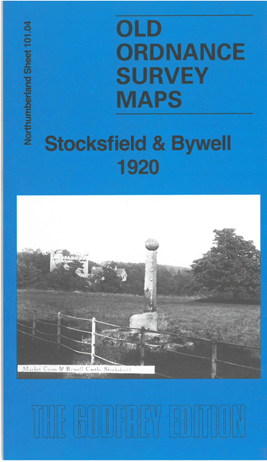
    This detailed map gives very good coverage of Stocksfield and Bywell.

    Features include River Tyne with Bywell Bridge, railway with Stocksfield station, Stocksfield village, Bywell Hall, Bywell House, St Andrew's church, St Peter's Church, Bywell Castle, Stocksfield Hall, Birches Nook, Merry Shield, Branch End etc.

    We also include an 1897 directory of Bywell together with a specially written introduction to the history of the area.


  • Follow this link for a complete list of our Northumberland maps. For other information and prices, and other areas, go to The Index Page.
  • Maps in the Godfrey Edition are taken from the 25 inch to the mile map and reduced to about 15 inches to the mile. For a full list of maps for the North East, return to the North East page.
    The Godfrey Edition / sales@alangodfreymaps.co.uk / 6 November 2025