
 Here is information about the map for Ashford:

This detailed map covers the central and southern part of Ashford, with coverage stretching from Coleridge Road and Chattern Hill southward to the Queen Mary Reservoir.
Features include St Matthew's church, Ecclesfield Convent, Old Ford Farm, golf course, many orchards etc. A commercial directory of Ashford is included on the reverse.
The map links up with Middlesex Sheets 19.16 Ashford North to the north.
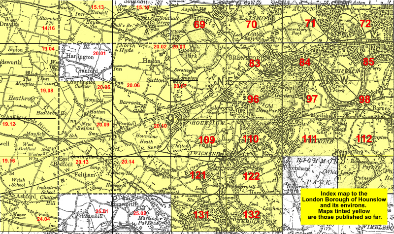 Follow this link for a list of our maps for the London Borough of Hounslow, or here for a complete list of our London maps .