Old Ordnance Survey Maps of Middlesbrough


  • For the old town of Middlesbrough we are issuing this wonderfully detailed Five-foot plan. Originally published at a scale of 1:1056 or 5 feet to the mile, we have reduced it in scale to 1:1760 or a Yard to the Mile. The maps, though covering quite a small area, are very detailed, even including the interiors of some public buildings, such as churches. For the urban historian they are perhaps the most fascinating maps ever published by the Ordnance Survey.
  • Each map includes a specially written introduction to the area. They are available through our On-line Mapshop

  • Here are the details of the large scale plan for Middlesbrough:

  • Middlesbrough 2 Middlesbrough Old Town 1857 - published 2025; intro by Alan Godfrey. ISBN.978-1-78721-885-7

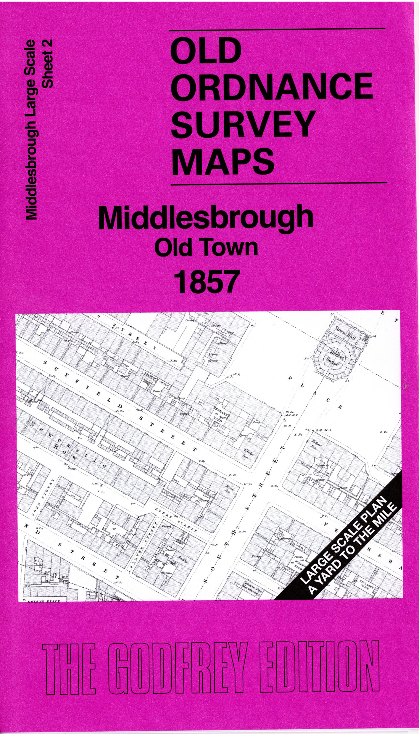
    This wonderfully detailed map covers the Old Town, based around the Market Place and its Town Hall.

    Features include St Hilda's church, chapels, windmill, Goods (former passenger) station), coal staiths, Exchanger Buildings, Stockton & Darlington Railway, Tees Side Iron Works, with the original streets around the Market Place, including many pubs and chapels.

    On the reverse we include a 1:500 plan covering the Market Place and immediate area in 1892, together with a 2,000 word introduction to the history of the area.


  • Follow this link for a complete list of our Middlesbrough Series maps. For other information and prices, and other areas, go to The Index Page.
  • This map is taken from the OS 5 foot plan map and reduced to a scale of A Yard to the Mile.' For a full list of maps for England, return to the England page.
    Alan Godfrey Maps, Prospect Business Park, Leadgate, Consett, Co Durham, DH8 7PW / sales@alangodfreymaps.co.uk / 11 July 2025