 Here are the details of maps for Blaenau Ffestiniog:

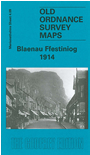
This map of Blaenau Ffestiniog, geographically shows two distinctive parts. To the west a desolate mountain mass, and to the right, the town itself. Festiniog Railway, which was built in 1836, runs vertically through the centre of the map swinging eastward to go through Blaenau. Close to the railway line through the town is St Davids Church and the Town Hall. Oakeley Square appears to the left of the town as does Moelwyn Mills (Woolen) which went under during the inter war depression. The map shows Rhywbryfdir which houses the local hospital and Trefeini which appears to the far right of the map. On the reverse of the map is an excerpt from sheet 04.13, directly south of 04.09 which indicates where the railway line started in Tan-Y-Grisiaw. The map also features a historical introduction by Derrick Pratt.