Old OS Town Plans of Manchester


  • For a few areas of Liverpool and Manchester we have also reprinted some of the very early Five-foot plans. Originally published at a scale of 1:1056 or 5 feet to the mile, we have reduced them in scale to 1:1760 or a Yard to the Mile. The maps, though covering quite a small area, are quite wonderfully detailed, showing such features as capstans and mooring posts, lamp-posts, the layouts of back yards, and even the interior of certain buildings such as churches. For the urban historian they are perhaps the most fascinating maps ever published by the Ordnance Survey.
  • Maps can be purchased on our On-line Mapshop.

  • Here are the details of the map for Ancoats (N):

  • Manchester Sheet 25 Ancoats (North) 1848 - published 2012; intro by Chris Makepeace. ISBN.978-1-84784-567-2

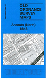
    This extremely detailed map covers the area area around Bradford Street, Bradford Road and Butler Street.

    Features include Rochdale Canal, Gaggt's Field area, Ashton Canal, Holt Town Reservoir, Shooter's Brook, New Islington Chapel, St Barnabas church, New Islington Mill, Rodney Street Mill, Butler Street Mill, Elizabeth Street Mill, Lloyd's Field Mill, etc. We include a selection of street directory extracts on the reverse.

    The map links up with Manchester Sheets 24 New Cross to the west, 30 Ancoats to the south.


  • Follow this link for a complete list of our Manchester Town Plans or here for other maps of Manchester.
  • You can order maps direct from our On-line Mapshop. For other information and prices, and other areas, go to The Index Page.
  • Maps in the Godfrey Edition are taken from the 25 inch to the mile map and reduced to about 15 inches to the mile. For a full list of maps for Lancashire, return to the North West page.
    The Godfrey Edition / sales@alangodfreymaps.co.uk / 1 Feb 2018